The mainpage concerns higher accuracy Apollo era crater depth and diameter measurements - typically for smaller satellite feature craters. This note concerns other recent catalogues involving larger named craters.
When comparing measurements for any one craters in the following catalogues - or against the higher precision measurements in the Apollo era catalogue - wide variations between catalogues may be found in reported crater depth or diameter. In this regard, it should always be remembered that measuring crater depths and diameters is a statistical affair. Measurements are expected to vary based on whether a particular measurement was made from Earth or a lunar oribiting satellite image, the era in which is was taken, the skill of the observer, the instruments used, the measuring method applied, and lack of circularity of the crater.
|
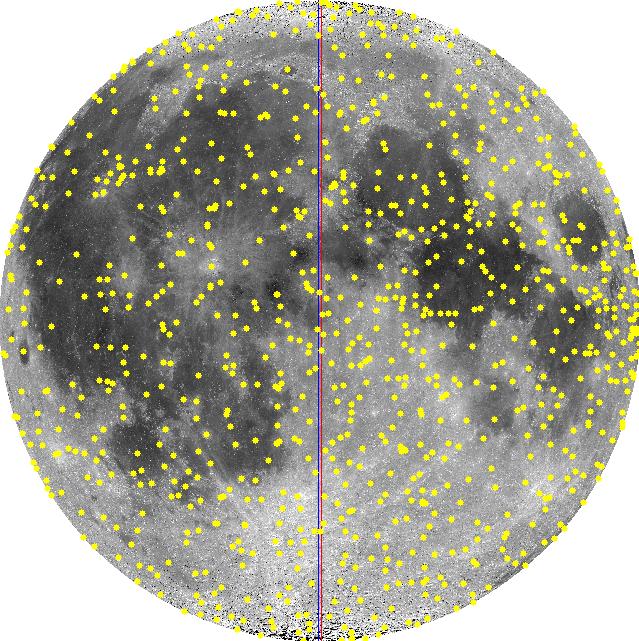
The best standard reference source for larger named crater depths and diameters is the Appendix in Dr. John Westfall's 2000 classic Atlas of the Lunar Terminator. An Appendix to the Atlas reports approximately 830 crater diameters and depths for named large nearside craters. Unlike Arthur (1974) who focused on small craters, Westfall (2000) focuses on large craters. A partial digitization of the crater catalogue in John E. Westfall's Atlas of the Lunar Terminator, Cambridge Univ. Press (2000) is provided here, with the author's permission as to this non-commercial purpose, limited internet distribution. The full catalogue can be found in his book that is available at libraries and on Amazon.com. Westfall's (2000) Appendix is a subset of his 7,000 plus personal unpublished nearside crater database. Westfall (11/2006), personal communication. Westfall's Appendix and personal database relies on 23 published sources as well as Dr. Westfall's measurements from Clementine images. Westfall (11/2006), personal communication. The Appendix does not list the source of the each measurement. It is not possible to determine if a specific measurement is higher accuracy data from the Apollo era or low-precision data from the early 1900 or 1800s. The distribution of about 780 craters on the nearside face of the Moon from Westfall's Appendix is shown in Figure 1. |
|
|
Also of note is the 1985 French astronomer Georges Viscardy's Atlas-guide photographique de la lune, which includes a substantial table of crater diameters and depths based on his shadow measurements. Viscardy's data forms the basis of depth and diameters for large named craters in Legrand's and Patrick Chevalley's Virtual Moon Atlas (VMA) software. VMA Pro version 3.5, released in November 2006, includes a lunar database called Datlun. The distribution of about 560 craters on the nearside face of the Moon from Viscardy's catalogue is shown in Figure 2. |
|
Cherrington, a former Hood college astronomy professor, did low-precision LAC chart take-offs to assemble crater and peak depths and diameters for about 1200 craters and other lunar features in the Gazetteer appendix to his Exploring the Moon through Binoculars and Small Telescopes. The Cherrington chart take-offs from NASA Lunar Aeronautical Charts (LAC) of the 1960s have a systematic bias of up to 1500 meters present in the original LAC charts. (Wood, 2006 personal communication); see Arthur (1974). Cherrington's 1969 appendix Gazetteer of large lunar craters was reviewed. Based on large, named-crater feature names, Cherrington's crater depths were associated with the position and name data in the USGS Gazetteer. Only the crater depth and peak height was digitized from Cherrington. NCLN and the USGS Gazetteer contain the more accurate crater diameters. The resulting digitizing of crater and feature depths is summarized as follows and are plotted in Figure 3. 83 low-precision central peak heights where also extracted from Cherrington (1969), shown in Figure 4.
|
|
|
No copyright is claimed as to any original materials on this web document. All original content by this author is released to the public domain. This website makes use of external content links that may be subject to copyright protection. No claim to copyright is made as to these linked external sources or any other external linked reference source.
Prepared by K. Fisher fisherka@csolutions.net Rev. 12/26/2006


