Photographer: Kurt Allen Fisher
Summary Author: Kurt Allen Fisher
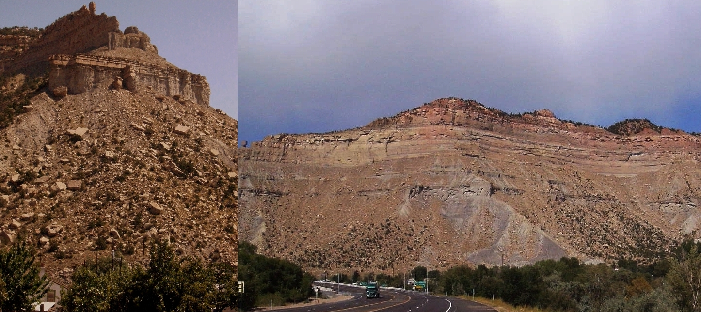
South of Helper, Utah, Utah's Highway 6 and the Price River pierces the western end of Utah's Books Cliffs - a 200 kilometer (125 mile) escarpment that stretches from Price, Utah to Grand Junction, Colorado. This almost unbroken 400 meter (1,300 foot) high escarpment is visible from space. The left-hand side of the diptych shows the east end of the escarpment on the right-hand side - where the Price River cuts through the Book Cliffs. The same Thor's Hammer shaped-rock appears at center-top of the left frame and at the left-center of the right frame.
This escarpment records major changes in Utah's topography between 66 million and 144 million years ago during the Cretaceous period. During the early Cretaceous period, a sea inudated Utah from the present day east. The gray bottom half of the Helper Face consists of Mancos Shale that was deposited while the sea was deep above this location. Mountains rose to the west and eroded towards this location in the east. This raised the relative level of the seafloor. These changes in topography are seen in the top two quarters of the Helper Face. The two prominent ledges above the Mancos Shale and the higher shear tan cliff face were formed when this location was part of a system of barrier islands of the east Utah coast. Sediments rich in organic matter where trapped by the barrier islands and formed coal bearing seams. Towards the end of the Cretaceous period, the land rose further at this location until it became a beach. This change is seen in the top redish-tan layers and cliff just below the tree-line. The redish-tan layers are the Mesaverde Group including Castlegate Sandstone - the remnants of petrified beachfront property.