Photographer: Kurt Allen Fisher
Summary Author: Kurt Allen Fisher
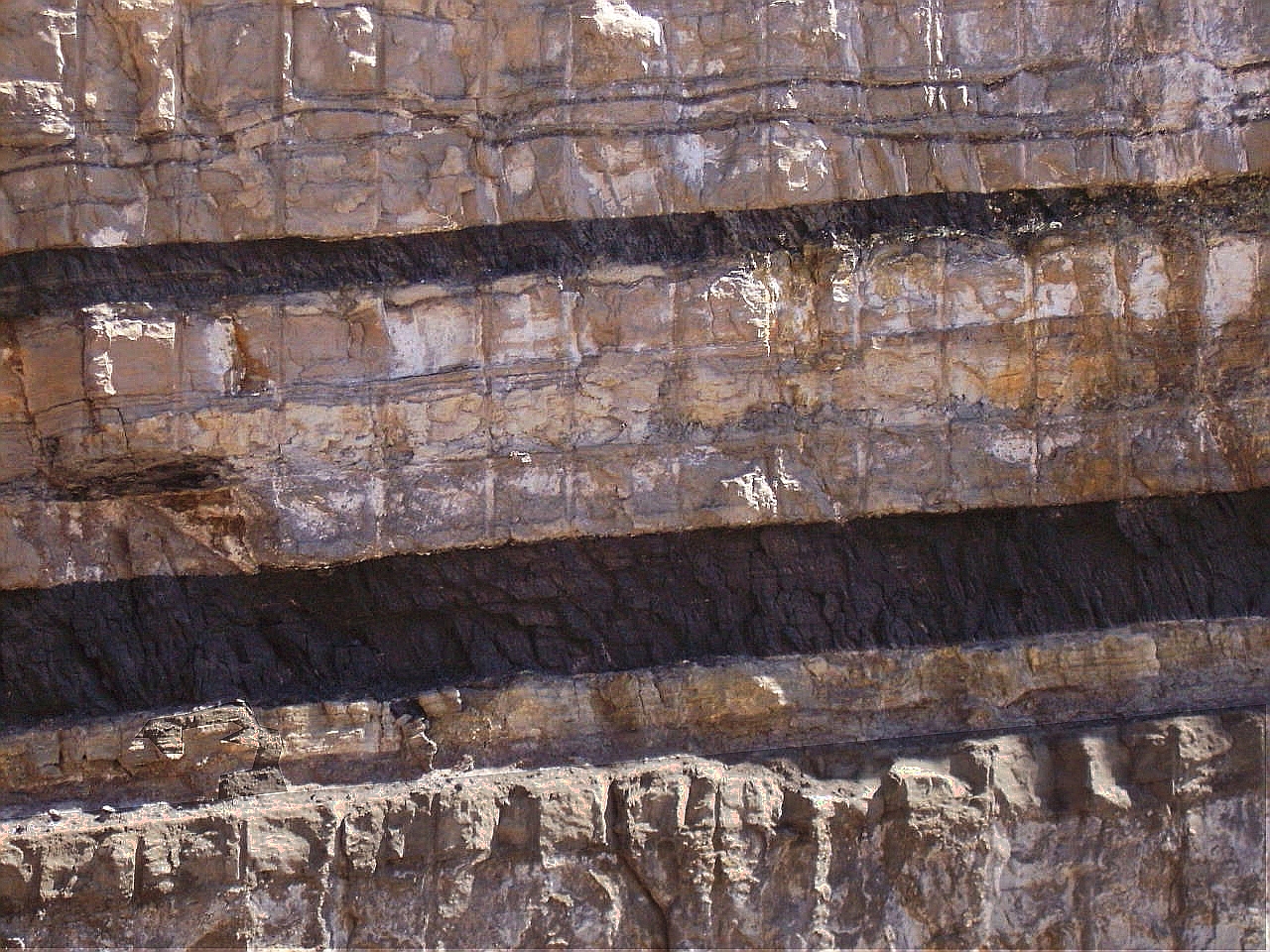
On Utah's Highway 6 at the junction with Ut-191 and north of Helper, Utah, a dramatic roadcut, 60 meters deep, exposes the half-meter thick coal seam of the Blackhawk Formation. This coal bearing formation was deposited in the Late Cretaceous between 65 and 99 million years ago and underlies an area stretching 225 kilometers between Price City in central Utah to Grand Junction in western Colorado. Cretaceous central Utah had an eastern seafront and coastal swamps and barrier islands trapped organic sediments transported from an ancient western mountain range. 80 million years ago the eastern seaboard of Utah may have resembled the Sea Islands off present day Georgia and South Carolina.
As modern urban consumers, we give little thought to where basic utility services - like electricity - come from. Coal from the Blackhawk seam is principally transformed into 1,800 megawatts of electricity (14 Gigawatt hours annually) by two power plants of the Intermountain Power Project (IPP) Agency (IPA) located 150 kilometers away from this coal seam in the central Utah town of Delta. The IPA is an interlocal governmental agency formed by Utah muncipalities. By agreement, 75 percent of the electricty generated by the IPP is exported to the southern California and is purchased by Los Angeles Department of Water and Power (LADWP) and the southern Californian cities of Anaheim, Riverside, Pasadena, Burbank and Glendale. This method of electricity generation allows higher densities of population in southern California, since the air pollution from coal-fired power plants can be exported and dispersed in a relatively unpopulated region 975 kilometers from the Los Angeles and Riverside Basins. The IPP provides benefits of electrical power in Californa and 500 jobs in rural Utah.