|
|
Primer on Nearside Lunar Geology: A Table of 835 Lunar Features by Geologic Era with Wilhems' Charts and Table of Lunar-Earth Analogues
|
An introduction to the geologic history of the nearside of the Moon and finder lists for 835 lunar craters and other features by lunar geologic era are provided based on Don Wilhems' 1987 classic, A Geologic History of the Moon, USGS Survey Paper 1348, Dr. Charles Wood's Lunar Picture of the Day (LPOD) image gallery, and USGS-NASA Geologic Atlas of the Moon charts, prepared by NASA as part of the Apollo program. Heavy reliance is made on 12 color geologic maps, Charts 1 through 12, at the back of Wilhems' Geologic History of the Moon in order to illustrate which portions of the nearside Moon relate to several major lunar geologic eras.
Examples of various lunar features are illustrated by linking to images at Wood's LPOD and NASA's Earth Observatory websites. This primer is intended to provide a quick index reference to images of key lunar features to support local amateur public and school star parties on the geologic era of features near the lunar terminator. It also should be considered a prefatory introduction to lunar geology prior to reading more in-depth books such as Wood's The Modern Moon: A Personal View, the introductory chapter to Westfall's Atlas of the Lunar Terminator, or Wilhems' technical Geologic History.
A freeware software alternative to this website is Christian Legrand's and Patrick Chevalley's Version 3.5, Professional Edition, of their Virtual Moon Atlas (VMA), software. The Pro Edition of VMA includes a database program - Datlun - that includes geologic era coding for about 2,800 out of approximately 7,800 nearside features. It was felt that the supplemental reference provided here that covers the same subject matter would have addition educational value to lunar enthusiasts, local astronomy clubs, and school children.
As a boy, I was always attracted to looking at the Moon as a giant three-dimensional map illustrating mountain ranges, valleys, bays, headlands and caldera-like craters. In the modern era, we take aerial and space-based photography of Earth features and detailed U.S.G.S. quadrangle maps - leading aids for visualizing the Earth's geological features - for granted. Before the invention of the airplane and computerized map-making, the Moon was the most easily accessible visualizations of aerial views of such features.
Before the Moon became physically accessible during the Apollo and Soviet Luna exploration era, whether the features of the Moon were created by volcanic or meteor impact processes remained an open question. The principle scientific achievement of the Apollo era was to demonstrate virtually all features on the Moon are of meteor impact orientation.
Today, the beginner looking at the Moon, particularly at the southern highlands, sees an apparent jumble of disorganized, random craters in varying degrees of ruin. There also is some apparent structure to Moon's nearside surface - easily seen in its round mares surrounded by towering mountain ranges. There is a structure and geologic story to face of the nearside Moon. Understanding that structure and how it was created can increase one's appreciation of the Moon and aid in locating and understanding its major structural and aesthetic star party showcase features.
When looking at linked figures and images in this document, in some browers, it may be necessary to click the image a second time in order to view a readable high resolution image. In Microsoft Internet Explorer, a second higher resolution image is available, if after the first click, an image opens that displays a plus sign when the mouse is hovered over the image.
The Earth differs from the Moon in two major qualities. The Earth has plate tectonics; the Moon does not. The Earth has a rock-weathering atmosphere; the Moon does not. As a result, the Earth's surface periodically erases its surface record. For the sea-spreading ocean floor, this occurs on a time scale of 100 to 150 million years; for the continental cratons, weathering may take 500 million years to wear away a mountain range. It is fortunate that we have a Moon without plate tectonics or atmospheric weathering because as a consequence of their absence, the Moon reflects a complete record of major solar system meteor bombardments going back about 3.8 billion years - nearly to the creation of the Earth itself.
Those major meteor bombardment eras - with examples of the major lunar features created in each era - are listed in Table 1.
| Period | Features | Begins B year before now | Ends B year bef now | Chart - Wilhems (1987) | ___________ | ___________ | Features from this era | Crater frequency (N per km^2) |
|---|---|---|---|---|---|---|---|---|
| Copernican | Rayed Fresh Craters | 0 | 1.1 | 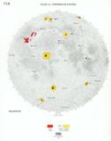 | Tycho L006 Tycho 2 Messier A L025 Linne 4km dia. Bright Copernican Craters near Gassendi | <7.5 x 10^-4 for >1 km craters on mares | ||
| Eratosthenian | Non-Rayed Fresh Craters | 1.1 | 3.2 | 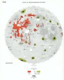 | Theophilus L008 | <7.5 x 10^-4 to <2.5 x 10^-3 for >1 km craters on mares | ||
| Imbrian | Maria Impact Basins | 3.2 | 3.85 | 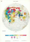 | 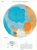 | 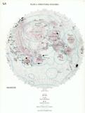 | Mare Imbrium | |
| Upper Imbrian | 3.2 | 3.84 | 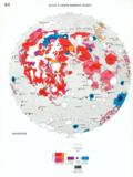 | Posidonius L020 | <2.5 x 10^-3 to <2.2 x 10^-2 for >1 km craters on mares | |||
| Lower Imbrian | 3.84 | 3.85 | 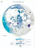 | Petavius L016 | <2.2 - 4.8 x 10^-2 to <2.2 x 10^-2 for >1 km craters in basins | |||
| Nectarian | Maria Impact Basins | 3.85 | 3.92 | 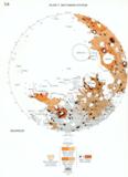 |  |  | Clavius L009 | <2.3 - 8.8 x 10^-5 for >20km craters |
| pre-Nectarian | Terrae | 3.92 | 4.55 | 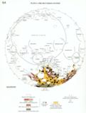 | Schickard L039 | >7.0 x 10^-5 for >20km craters | ||
| pre-Imbrian | another name including both the Nectarian and pre-Nectarian | 3.85 | 4.55 | |||||
| Era color coding | |
As can be seen in the preceding table, much of the near-side face of the Moon was reshaped in the lower-Imbrian era by heavy bombardments that created the major nearside mares. (Wilhems 1987, pp. 190, 245, 278).
Aside from the lower Imbrian bombardment, craters on the face of the near-side of the Moon are the result of processes working over geologic time scales and not relatively heavy, short bombardments. Even the heavy higher-rate Nectarian and lower Imbrian bombardments occurred over a one-half billion year period. Figure 2. The cratering rate for each geologic era is shown Figures 1 and 2. For craters larger than 20 kilometers, the present cratering rating is about one-fifth estimated for Imbrian times. For small craters less than 1 kilometer in diameter, the current rate is one-thousandth an estimated Imbrian rate.
The nearside has many large mares; a feature type almost absent from the farside. The farside surface contains a larger percentage of older terrian.
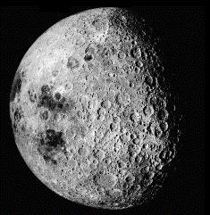 Figure 3 - Apollo 16 photograph AS16-3021 of the lunar farside courtesy of NASA |
 Figure 4 - Farside lunar geologic map. Plate 12B in Wilhems (1987). |
That pattern is probably the result of lunar tidal locking. After creation, the Moon became tidally locked such that the Moon rotates at speed that keeps the same side always pointing towards the Earth. The gravity differential caused the Moon to become egg-shaped and the lunar crust to be thicker (50km) on the farside and thinner (12km) on the nearside. Although both sides of the Moon received large body impacts, on the thinner nearside we see major basin and mare impact structures where lava in the young Moon's mantle could reach the surface through impact-related fractures in the lunar crust.
| Mare in impact basin | Era | Rükl L100 | Basin ring remnant | Rükl L100 | Tilted crater on mare edge | Rükl L100 | Rille system tangent to basin ring | Rükl L100 | |
|---|---|---|---|---|---|---|---|---|---|
| Crisium | Nectarian | 25, 26, 37, 38 L010 | Dorsum Oppel Geminus Ring [Montes Wasatch]* | 26 16 26 | Yerkes | 26,37 | |||
| Serenitatis | Imbrian | 13, 14, 23, 24 | Posidonius | 14 L013 | Rimae Sulpicius Gallus Rima Menelaus | 23 24 | |||
| Tranquilitatis | Imbrian | 35, 36, 37, 45, 46, 47 | Mare ridges near Lamont | 35 | Julius Caesar | 34 | Rima Sosigenes | 35 | |
| Fecunditatis | Pre-Necatarian | 48, 49, 37, 59 | Gutenburg | 48 | Rima Goclenius | 48 | |||
| Nectaris | Nectarian | 47, 58 | Rupes Altai Rheita Valley (large secondary impact chain) | 57 L007 68 L058 | Fracatorius | 58 L021 | Rima Fracatorius | 58 L021 | |
| Imbrium | Imbrian | 9, 10, 11, 12, 19, 20, 21, 22 | Mons Archimedes (inner Imbrium ring) Dorsum Zirkel | 22 20 | Sinus Iridum | 10 L014 | |||
| Nubium | Imbrian | 53, 54 | Pitatus | 54, 64 L084 | Rupes Recta (Straight Wall) Rima Hesiodus | 54 L015 54 | |||
| Humorum | Nectarian | 50, 51 | Unnamed wrinkle ridges in Mare Humorum | 52 | Gassendi Doppelmayer | 52 L013 | Rimae Hippalus | 52, 53 | |
| Orientale | Imbrian | 39, 50, VII L020 | Mons Cordillera Mons Rook | 39, VII |
One type of feature, the distribution of which is not fully explained by the basin impact theory, is lunar domes. Wood, Modern Moon at 62-63. Domes are small volcano-like features generally less than 500 meters tall that are believed to be similar to lava domes or shield volcanoes on the Earth. Examples of these features are provided in Table 3 in the following section. Westfall (2000) (at 54) feels at least the larger domes fields, like the Hortensius Domes, appear to be distributed clustered around the edges of the mares.
"Analogue morphology" means for the purposes of the following table, landforms that are similar in appearance, but not necessarily created by the same geologic process. Analogies are different from homologies that are both similar in appearance and cause. For example, a pit and rille on the Moon may be caused by a small meteor impact and subsequent subsurface melting. On Earth, a similar landform may be caused by a small volcano. On the Moon, a long scarp like Rupes Altai is associated with a large basin impact; on the Earth, a scarp like the Niagra Escarpment is associated with geochemical processes. In general, the geologic processes that form lunar features are not the same forces that create similar terrestrial landforms.
While the comparative appreciation of the morphology of Earth and lunar features is instructive, care should not be taken to attribute volcanic causation to many lunar features. That almost all lunar features are the result of basin impact processes was the hard-won knowledge result of the Apollo program. For essays about the pre-Apollo views on the Moon, see Fielder (1961). In this regard, the following table of lunar features provides a science education launch point to discuss basic logical reasoning regarding proof of causation.
* - Not IAU sanctioned names. Informal feature names suggested by C. Wood.
Using the USGS-NASA Geologic Atlas charts and era assignments in Wilhems' Geologic History of the Moon, geologic eras were assigned to 835 lunar features. Tables sorted by name and lunar latitude and longitude are provided. The "Table of Features with Geologic Eras by Lunar Latitude and Longitude" can be imported into a spreadsheet, like Microsoft Excel. In Microsoft Excel, simply paste the url of the table into the "Open | File" dialogue. Excel's sort ( Data | Sort ) and/or auto-data filter feature ( Data | Filter | Autofilter ) can be used to drill-down to those features that are near the lunar terminator on a particular night. Using such a spreadsheet and once the longitude of the lunar terminator is known, star party tours by lunar geologic eras can be quickly created for a particular night.
The Moon has color; we just do not see them because the reflected light of the Moon is too dim to trigger color receptors in the human eye. (At night during the full Moon, you see objects in black-and-white.) A film or digital camera accumulates sufficient light to trigger color sensors on film or on the electronic receptor of a digital camera - as seen in the following LPOD images:
The color and brightness of the surface of the Moon is a result of its chemical composition and fading caused by micro-meteor bombardment over a geologic time scale.
Relatively fresh craters - Copernican craters that are "only" less then a billion years old - are surrounded by bright ejecta rays. The high reflectance - or albedo - of these rays is the result of the glass crystalline content of the ejected material and the chemical composition of underlying mare bedrock. Fresh bedrock material is dispersed by a meteor's impact and the shock of the impact turns a portion of the bedrock into a crystalline glass. This crystalline glass has a high albedo. The bedrock typically is covered by a 5 or 6 meter layer of darker lunar soil - called regolith - which has a lower content of crystalline glass and a lower albedo. Wilhems (1987) at 95.
|
Micro-meteors and the harsh space environment transform this fresh bedrock and its high-reflectance crystalline glass into darker regolith. Today, the Moon is continually bombarded by small meteorites and meteorite sand grains, as recently popularized by reports regarding a Nov. 7, 2005 and a May 2, 2006 meteor impact on the Moon captured by Earth-based NASA robotic patroller telescopes at the Marshall Space Flight Center. Such small impacts have been regularly captured for many years by amateurs, including by members of the Meteoritic Impact Search Program of the Lunar Section of the Association of Lunar and Planetary Observers (ALPO). One result of this continual micobombardment is the creation of the fine powdery lunar soil - the regolith - seen in a famous photograph of Buz Aldrin's first bootprint on the surface of the Moon. The continual microbombardment churns the lunar surface soil causing changes in its chemical composition and brightness. A second result of continual micrometer bombardment is the gradual fading of bright crater rays as seen surrounding the crater Tycho. The broad-scale colors seen on the Moon's surface in Filipe Alves's image of the Moon - the blue mares and the orange and orange-reddish highlands - are the result of chemical composition of the underlying source materials and the relative fraction of titanium, aluminum and iron in each region. |

Figure 6 - Courtesy of NASA. Apollo 11 bootprint on the Moon |
| Color | Description |
|---|---|
| Blue | "Ti-rich, spectrally blue lavas form at least half of Mare Tranquillitatis, the adjoining border of Serenitatis, the lobate flows of Mare Imbrium, central Mare Humorum, and much of Oceanus Procellarum. . . .." |
| Red | ."Red spectral classes, thought to be lowest in Ti content, are concentrated in Lacus Somniorum, Mare Frigoris, Sinus Roris, and northern Mare Imbrium; that is, they occur in diverse settings over the north half of the Procellarum basin.." |
| Red - mISP | "Red spectral class mISP forms extensive areas in central Serenitatis and the outer trough of western Procellarum.." |
| Orange | "Class hDWA occurs at several mare margins and fills most of Mare Vaporum. On the color-difference photographs, its color appears to be intermediate between red and blue and has been called 'orange' . . ."" |
| Orange-red - mIG | "Orange or (partly) red spectral class mIG- covers much of the area west of the central meridian and south of the strong blue-red association in Mare Imbrium. Apollo 12 landed within this belt. This class also forms much of Mare Crisium and Mare Fecunditatis. . . . . Orange spectral classes mBG-, characteristic of Mare Nectaris, and LBG-, common among the northern very red units, also are probably Al-rich. . . . . One interpretation of the orbital geochemistry is that Maria Smythii, Fecunditatis, and Crisium are all Al-rich. . . . " |
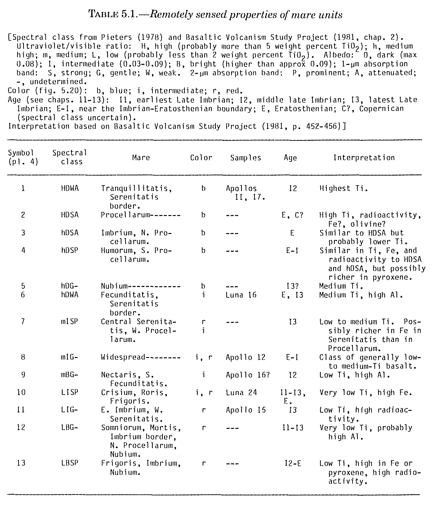
Figure 7 - Table 5.1, Remotely Sensed Properties of Mare Units. In Color, Chap. 5 (pp. 96-99) in Wilhems, Don. 1987. A Geologic History of the Moon, USGS Survey Paper 1348
All of these chemical changes occur in an oxygen-free space environment. Apollo astronauts report that once back in their lander module, fresh moon dust has a burnt smell. But after lunar rocks are returned to the Earth, they are odorless. Although the reason for the smell is not known - one explanation for the smell is that metals and other compounds in the soil oxidize on their first exposure to air.
Use of the USGS-NASA Geologic Atlas of the Moon is complicated by the dense colors and features on the charts. Not all satellite craters are indicated on the charts. Typically, effective use of these NASA Apollo era lunar geologic charts requires supplemental reference to both a good lunar atlas, like Rükl's Atlas of the Moon and U.S. Air Force-NASA Lunar Aeronautical Charts (LAC). This is particularly true when trying to find smaller craters less than 20 kilometers in diameter.
Chart numbers listed in the "Table of Features with Geologic Eras by Name" and the "Table of Features with Geologic Eras by Lunar Latitude and Longitude", refer to LAC chart numbers and not the geologic chart numbers. An index cross-reference map between the "LAC" chart numbers and the geologic atlas charts is provided at the main LAC page. The duplicate "I" chart numbers for the geologic charts are not listed in the geologic era reference table provided here, since both the LAC and geologic charts cover the same area.
Table 14.2 in Wilhems' Geologic History suggests 18 supplemental sites for sample return missions in order to better calibrate the absolute ages of surface rocks. The sites include the South Pole-Aitken Basin massifs, the Nectarian mare floor, floor melt in Copernicus, a farside mare and the lava dome Gruithuisen gamma. In 2004, NASA announced in its Vision for Space Report a return-to-the-Moon initiative. In 2006, the U.S. National Academy of the Sciences issued a recommendation - the Scientific Context for the Exploration of the Moon Report - that suggested targeted science missions for the NASA return to the Moon program. Recommended activities were similar to Wilhems' 1987 recommendations: (1) return a sample from the South-Aitken Basin, (2) maximize the diversity of lunar samples, filling in rock sample gaps from the Apollo era explorations, and (3) investigation of more recently discovered, potential ice deposits at the lunar poles.
In addition to prior remote sensing missions like Clementine (1994), Lunar Prospector (1998) and SMART-1 (2006), the following near term (2007-2010) remote sensing missions are planned by the United States, Japan, China and India:
| Year | Name | Country | Will do* | Mission url |
|---|---|---|---|---|
| 2007 | Selene | Japan | Two subsatellites with 14 science instruments will do multispectral and high-resolution imaging to support future missions. [Size of a school bus.] | Link |
| 2007? | Chang’E | China | Obtain lunar surface three-dimensional stereo image; analyze distribution of useful elements and estimate abundance; survey thickness of soil and evaluate resource of He-3. | Link |
| 2007/2008 | Chandrayaan-1 | India | High-resolution remote sensing of the lunar surface features in visible, near infrared, X-ray and low energy gamma ray regions. | Link |
| 2008 | Lunar Reconnaissance Orbiter | United States | Moon's radiation environment, map the lunar topography in high-resolution, scan for resources in the polar regions and map the composition of the lunar surface. | Link |
| 2010 | Lunar-A | Japan | Seismology using penetrators. | Link |
* - Except as to Lunar Recon. Orbiter, quoted from NASA. 1/24/2005. International Participation in Lunar Exploration. (Slide Presentation). http://www.hq.nasa.gov/office/apio/pdf/moon/08_international_kirkham.pdf
Wilhems (1987) was reviewed and a table of approximately 190 lunar geologic eras assigned to lunar features was created. The USGS-NASA Geologic Atlas of the Moon charts were reviewed and the geologic eras for approximately 645 features were extracted and added to a reference table containing a total of 835 lunar features.
The reference table codes from the USGS-NASA Geologic Atlas charts are based on the geologic eras assigned in those pre-Apollo exploration charts. In the early 1960's Geologic Atlas charts, the Pre-Nectarian and Nectarian eras are combined into one era - the Pre-Imbrian. Based on later Apollo exploration lunar sample returns, the Pre-Imbrian era was later subdivided in Wilhems (1987) into the Pre-Nectarian and the Nectarian eras.
In the reference table provided here, all geologic era assignments extracted from the Geologic Atlas charts for the upper and lower Imbrian eras were assigned a single group coding - the Imbrian era.
This review and extraction process occurred during October and November 2006. On November 6, 2006, Christian Legrand and Patrick Chevalley issued Version 3.5, Professional Edition, of their Virtual Moon Atlas (VMA), software. The Pro Edition of VMA includes a database program - Datlun - described above. Since this project was substantially completed, it was decided to distribute it for its supplemental educational value to lunar enthusiasts.
This note is amateur astronomer work product. Corrections to any errors are welcomed and appreciated.
When purchasing any used or new books on this list through Amazon, using the Amazon link at Dr. Charles Wood's Lunar Picture of the Day (LPOD) contributes part of the purchase price to supporting the LPOD website.
USGS-NASA. ____. A Geologic Atlas of the Moon. (Out-of-print geologic maps web redistributed by the Lunar Planetary Institute)
Fielder, G. 1961. Structure of the Moon's Surface. (Pre-Apollo era views about lunar geology). Pergamon Press. New York.
Hartmann, W.K. and Wood, C.A. 1971. Moon: Origin and Evolution of Multi-Ring Basins
Heiken, Grant H. et al (eds). 1991. Lunar Sourcebook: A User's Guide to the Moon. Cambridge Univ. Press. (Out-of-Print publication web distributed by LPI)
Masursky, H., Colton, G.W., El-Baz, F. 1978. Apollo over the Moon: A View from Orbit. (NASA SP-362)
NASA. Nov. 6, 2006. Bizarre Lunar Orbits. (Mascons)
Schultz, Peter H. 1976. Moon Morphology: Interpretations based on Lunar Orbiter Photography. Univ. of Texas Press.
Spudis, P.D. and Bussey, D.B. 2006. Clementine Explores the Moon. http://www.lpi.usra.edu/publications/slidesets/clem2nd/
Westfall, John E. 2000. Table 2.1. Lunar Geologic Time Scale. In The Moon's Surface Features. Chapter 2. In Atlas of the Lunar Terminator. Cambridge Univ. Press.
Westfall, John E. 2000. Atlas of the Lunar Terminator. Cambridge Univ. Press.
Wilhems, Don. 1987. A Geologic History of the Moon, USGS Survey Paper 1348
Wood, C.A. 2004. The Modern Moon: A Personal View. Sky Publishing.
Wood, C.A. & Anderson, L. 1978. New morphometric data for fresh lunar types. 1978LPSC....9.3669W
Bussey, B. and Spudis, P.D. 2004. The Clementine Atlas of the Moon. - U.S.G.S. Map-A-Planet Online applet
Lunar Planetary Instit. Lunar Atlases Online
Lunar Planetary Instit. chart catalogue
Rükl, A. 2004 (2ed). Atlas of the Moon. Sky Publishing.
USGS-NASA. ____. A Geologic Atlas of the Moon. (Out-of-print geologic maps web redistributed by the Lunar Planetary Institute)
U.S. Air Force. ____. Lunar Aeronautical Charts. (LAC).
USGS. 2005. Gazetteer of Planetary Nomenclature.
USGS. 2006. Map-A-Planet - Clementine 790nm Baseline Images - Online Web Applet
Viscardy, Georges. 1985. Atlas-guide photographique de la lune: ouvrage de référence ŕ haute résolution. Masson. ISBN/ISSN/EAN : 2-225-81090-7
Astronomical League. 2006. The Lunar Club Observing List.
Ash Observatory. 2006. The Lunar 100 List (List and images). http://mysite.verizon.net/vzeed81b/lunar1001_50.html
NextStar50Club. 2005. NextStar Club Lunar 50 List. (Web document) http://www.nexstarsite.com/nexstar50club.htm
Rükl, A. 2004 (2ed). The Rükl 50. In Atlas of the Moon. Sky Publishing.
Wood, C.A. 2006. The Lunar 100. Sky & Telescope
Chevalley, Patrick and Legrand, Christian. 2006. Virtual Moon Atlas. (Software)
Douglass, E. (Lunar Planetary Instit.) 2003. Consolidated Lunar Atlas. (Web document)
Fisher, Kurt A. (amateur). 2006. Index to Lunar Picture of the Day. (By feature name)
Hager, M.A. et al. (Lunar Planetary Instit.) 2005. Apollo Image Atlas. (Web document)
NASA. 2006. Image Gallery. (Image archive)
NASA. 2006. The Apollo Gallery. (Image archive)
Teague, K. 2006. The Project Apollo Archive. (Over 2,200 scanned photographs, most taken in lunar orbit or on the surface, by Apollo lunar missions)
Wood, C.A. 2006. Lunar Picture of the Day. (Website) http://www.lpod.org
Wood, C.A. 2006. Lunar Picture of the Day Coppermine User Image Gallery. (Website) http://lpod.org/coppermine/
JPL/NASA. 2006. NASA Planetary Photojournal.
NASA. 2006. Earth Observatory (Image server)
NASA. 2006. Visible Earth. (Image server)
NASA. 2006. Gateway to Astronaut Photography of the Earth. (Image server)
Short, Sr. N. & Blair, Jr., R.W. 1986. Geomorphology from Space. NASA. (Out-of-print book; web distributed)
Barringer Crater Co. 2006. Barringer Meteor Crater [Meteor Crater, Arizona]. (Website)
Clark, M. (Whitepeak Obs.). 2006. Walking the Moon on the Earth: Lava Tube, Ape Cave, WA. (Website)
Clark, M. (Whitepeak Obs.). 2006. Walking the Moon on the Earth: Newberry, Oregon Geologic Fieldtrip. (Website)
Hamilton, Carlton. _____. Terrestrial impact craters. (Gallery). In Views of the Solar System. (Website)
Hamilton, Carlton. _____. Isla Isabella Volcano. In Terrestrial volcanoes. (Gallery). In Views of the Solar System. (Website) (slumped crater walls)
JPL/NASA, Near Earth Object Program. _____. Image of Aorounga Crater: A
Possible String of Impact Craters, Chad. (Webpage) (Catena).
Kanbur, Z. , Louie, J. N. et al. 2000. Seismic Reflection Study of Upheaval Dome, Canyonlands National Park, Utah, Journal of Geophysical Research - Planets, 105(E4):9489-9505
Koeberl, C. & Sharpton, V.L. 2001. Terrestrial Impact Craters. (Slide set) LPI Contrib. No. 1083 (Online and Hardcopy)
Louie, J.N., Chavez-Perez, S., & Plank G. Impact Deformation at Upheaval Dome, Canyonlands National Park, Utah, Revealed by Seismic Profiles.
Mouginis-Mark, P. 1993. Volcanic Features of Hawaii and Other Worlds. Lunar Planetary Instit. (Online and Hardcopy)
Owen, Doug, National Park Service. ____. Geology of the Craters of the Moon National Monument and Preserve. (lava tubes and rilles)
Phillips, Nicole. 2006. Volcanoes of the Eastern Sierra Nevada: Geology and Natural Heritage of the Long Valley Caldera. (Webpage) (domes)
Planetary and Space Science Centre, Univ. of New Brunswick. 2006. Earth Impact database.
Schenk, P.M., Gwynn, D. and Tutor, J. 200_. The Solar System in 3-D. (Slide set) LPI Contribution No. 942 (Online and hardcopy)
Short, Sr. N. & Blair, Jr., R.W. 1986. Geomorphology from Space. NASA. (Out-of-print book; web distributed)
USGS, Cascades Volcano Observatory. 2006. Lava Domes, Volcanic Domes, Composite Domes. (Webpage).
Katmai Volcano Dome in Alaska.
U.S. National Park Service. 2006. Craters of the Moon National Monument Website (lava tubes and rilles)
U.S. National Park Service. 2001. Activity 1, Classroom Activities in Geologic Investigation at Craters of the Moon [National Monument]. (Webpage).
Snake River Plain Basaltic Flow. (Mare flow analogue)
Snake River Plain Straight Rift with Cinder Cone. (Straight rille analogue)
Slot Vent, Big Southern Butte. (Fossa analogue).
Bear Crater. (Sinuous rille analogue).
Pit Crater and Collapsed Lava Tube. (Sinuous rille analogue).
Lava Pressure Ridge on Snake River Plan. (Mare wrinkle ridge analogue)
Instructor's Guide
Univ. of Texas. 2006. Grace (Gravity Recovery and Climate Experiment) Satellite (Website) (Earth's gravitational anomalies)
Wickman, Robert. ____. Volcanism on the Moon. In Volcano World. (Webpage)
Wickman, Robert. ____. Undara, Queensland, Australia Volcanic Tube. In Volcano World. (An Earth dorsa ridge analogue)
Wickman, Robert. ____. Lava Tubes. In Volcano World. (Rille analogues)
Wood, C.A. 9/1/2006. Black and White and Color All Over. LPOD (10.6 day old Moon in color by Aupperle, Milton) http://www.lpod.org/?m=20060901
Wood, C.A. 3/7/2004. Color Moon Map. LPOD. (Image by Alves, Filipe) http://www.lpod.org/archive/archive/2004/03/LPOD-2004-03-07.htm
Wood, C.A. 2/22/2006. Magical Bi-color Moon. LPOD.(Image by Alves, Filipe) http://www.lpod.org/?m=20060222
Table 5.1, Remotely Sensed Properties of Mare Units. In Color, Chap. 5 (pp. 96-99) in Wilhems, Don. 1987. A Geologic History of the Moon, USGS Survey Paper 1348
Pieters, C.M. 1977. Characterization of lunar mare basalt. LSCP 8(1):1037-1048
Pieters, C.M. 1978. Mare basalt types on the front side of the moon: A summary of spectral reflectance data. LPSCP 9(3):2825-2849

No copyright is claimed as to any original materials on this web document. All original content by this author is released to the public domain.
This website makes extensive use of external content links, particularly to Dr. Charles Wood's LPOD site and to individual amateur images incorporated at the LPOD site that are subject to copyright protection. No claim to copyright is made as to these linked external sources or any other external linked reference source. All external, linked reference sources are identified by hover boxes labeled "Click to link to external content".
This website incorporates several reproductions of plates and graphs from Wilhems' 1987 Geologic History book. That publication was prepared by the U.S. Geological Service and as a publication of the United States is not subject to copyright and is part of the public domain.
Linking to M. Clark's Whitepeak Observatory images of terresterial features is by permission.
Prepared by K. Fisher fisherka@csolutions.net Rev. 12/26/2006